
From Opensnow.com:
SUNDAY SNOW (March 1):
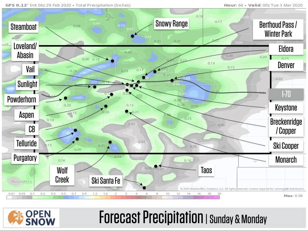
On Sunday, expect snow showers with light and random accumulations. Then the best chance for steadier snow will be on Sunday night through Monday midday. Most model forecasts show a few narrow lines of deeper snow with most areas seeing lighter snow. For example, the American GFS model forecast (above).
Any area that gets lucky and sees the most intense lines of snow could receive up to 10 inches by Monday midday. Most other areas will see maybe 2-5 inches of snow. So for Monday, there could be a legitimate powder day at a few spots, but on average this storm might feel underwhelming.
From Tuesday through Thursday we could see pulses of cooler air and light snow track over the northern mountains, though the most energy will stay to the north of Colorado so I think we’ll see just light amounts of new snow.
Winter just keeps on giving!